Over the past several months, we’ve launched a number of large Bullseye improvements including support for UK and Australia, our new responsive design and a migration to new servers. Along the way however, we’ve also been making smaller updates that are not really large enough for a dedicated announcement, but that we wanted you to know about.
Some of these are backend changes to improve performance or make things easier from a user perspective. Others are features that you’ve requested or that we thought would be worth including in our interfaces. View the full list of Bullseye’s store and dealer locator features.
This blog post is dedicated to those minor updates that we want you to know about and that we believe make us the leader in turn-key store locator software solutions. Here we go…
1. Location Name Search with Custom Label
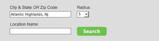
Our new location name search feature allows users to search by store or location name . It is actually a refactoring of the keyword search on our original list interface. Now however, searches do not require a geographical component. The label on the interface can be controlled through labels setting in the admin.
Works for Side Map and Top Map interfaces, but not for Standalone.
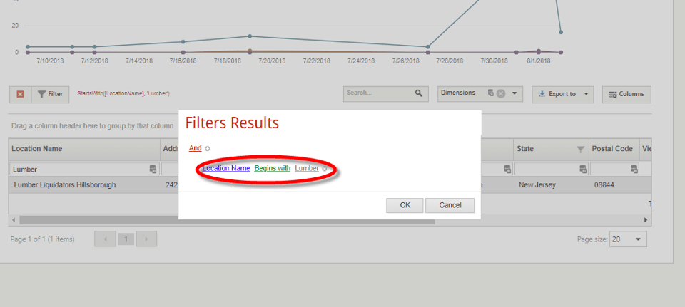
2. Include Category Filter as Drop-down
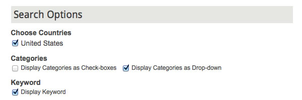
As many of you know, our category search used a checkbox format which would automatically give you results that match your category selections. While this checkbox format is great for displaying results from multiple categories at the same time, it’s not user friendly if you have a large number of categories. To help with that, we’ve added the ability to choose a drop-down option and include that in your search filter.
Works for Side Map and Top Map interfaces, but not for Standalone.
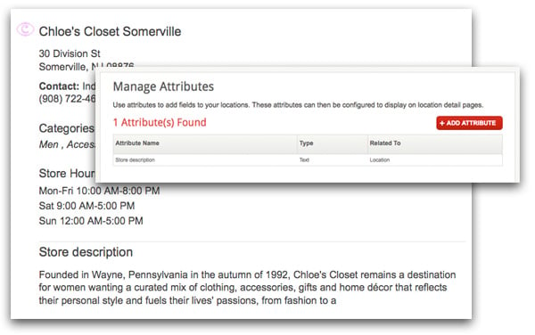
3. Display Categories in Store Locator Software Search Results
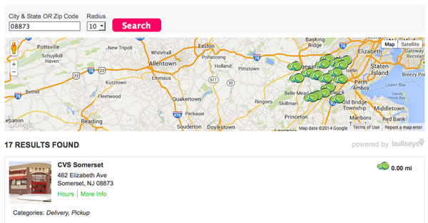
If locations offer specific services or sell specific products and you want to display that information on the search results, you now can–even if you are not allowing users to filter on categories.
Works for Top Map interfaces, but not for Side Map or Standalone.
4. Modify Map Height
Looking for more control over map display? Want a taller map? Now we’ve added a configuration option to let you change the standard map height from 210 to something that fits your design.
Works for Top Map interfaces, but not for Side Map or Standalone.
5. Upload Improvements for Companies with Large Datasets
Our .csv upload has 2 upload types–append and clear and append. Append works great if you are simply adding locations. But many of our clients manage locations outside Bullseye in 3rd party systems or in excel spreadsheets. Ideally, they should migrate to the XML import. But if they want to use .csv, the only option that works is clear and append which deletes the old records and adds new ones.
This is not a big deal if you have 4,000 locations. But if you have 100,000 locations, the upload can take a while to complete and can sometimes even timeout. The XML import uses a different method. In the XML import, we actually compare the records in Bullseye with the incoming records to determine what has changed and then only update records that need to be updated. Depending on the amount of time since the last update and the number of records being updated, this can be extremely fast.
In order to take advantage of this architecture, we’ve setup a trigger on the upload so that when the number of records is greater than 10,000, it will move to doing an XML import instead of our .csv import. Using this method requires populating the 3rd party ID field so that Bullseye can determine which records have been modified. You can include it yourself. However, if there is no value Bullseye will populate the value the first time you do an upload. Then going forward, you’ll need to download a .csv file which has the 3rd party ID and use that to manage locations.
It’s a little bit of work to get started. However, the work involved in setting things up at the beginning is worth the time you’ll save waiting for uploads to complete. We’re always available to help.
Works for all interfaces.
6. Country Search for United States and Canada
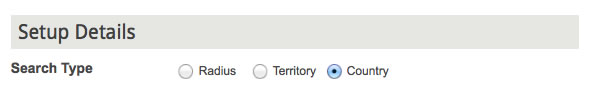
Country search lets you return all results for a single country at the same time. If you only have a handful of locations in the US or Canada this is a good option because users will always get results-even when there are no locations in their area.
When this rule is configured, all results within a country will be returned. In combination with our automated IP detection and search, this provides a great way to show all locations in a country on page load. Keep in mind that the maximum number of results that can be returned is set to 150.
Works for all interfaces.
7. Implementation of Schema Markup
As the web becomes deeper and richer with content, the search engines are looking for better and more effective ways to index content. To achieve that, they defined a set of standards for formatting HTML5 for specific types of data. The code is written in microdata and is not viewable to humans on a website, but is viewable to search engines looking for content.
A key component of the the Schema.org standards are use of tagging for local businesses. Our newest responsive interface including location landing pages and events all have Schema markup integrated. Here are some links to provide more information on Schema Markup.
How to Use Schema Markup for Local Seo
Works for Top Map interfaces, but not for Side Map or Standalone.